
The Fall Line Trace Trail is part of a larger network of trails called the Dragonfly Trail System in Columbus, Georgia. It is the northernmost trailhead for the system and if you start at that trailhead, you can ride approximately 10.5 miles, dead ending into the Chattahoochee Riverwalk Trail. At the end point you can go right, or left, and ride the length of the Riverwalk bike trail that goes throughout Columbus, GA.
We are covering the Chattahoochee Riverwalk Trail in another post, so stay tuned for that one. In this post we want to show you a small glimpse of what you will see on the Fall Line Trace Trail.

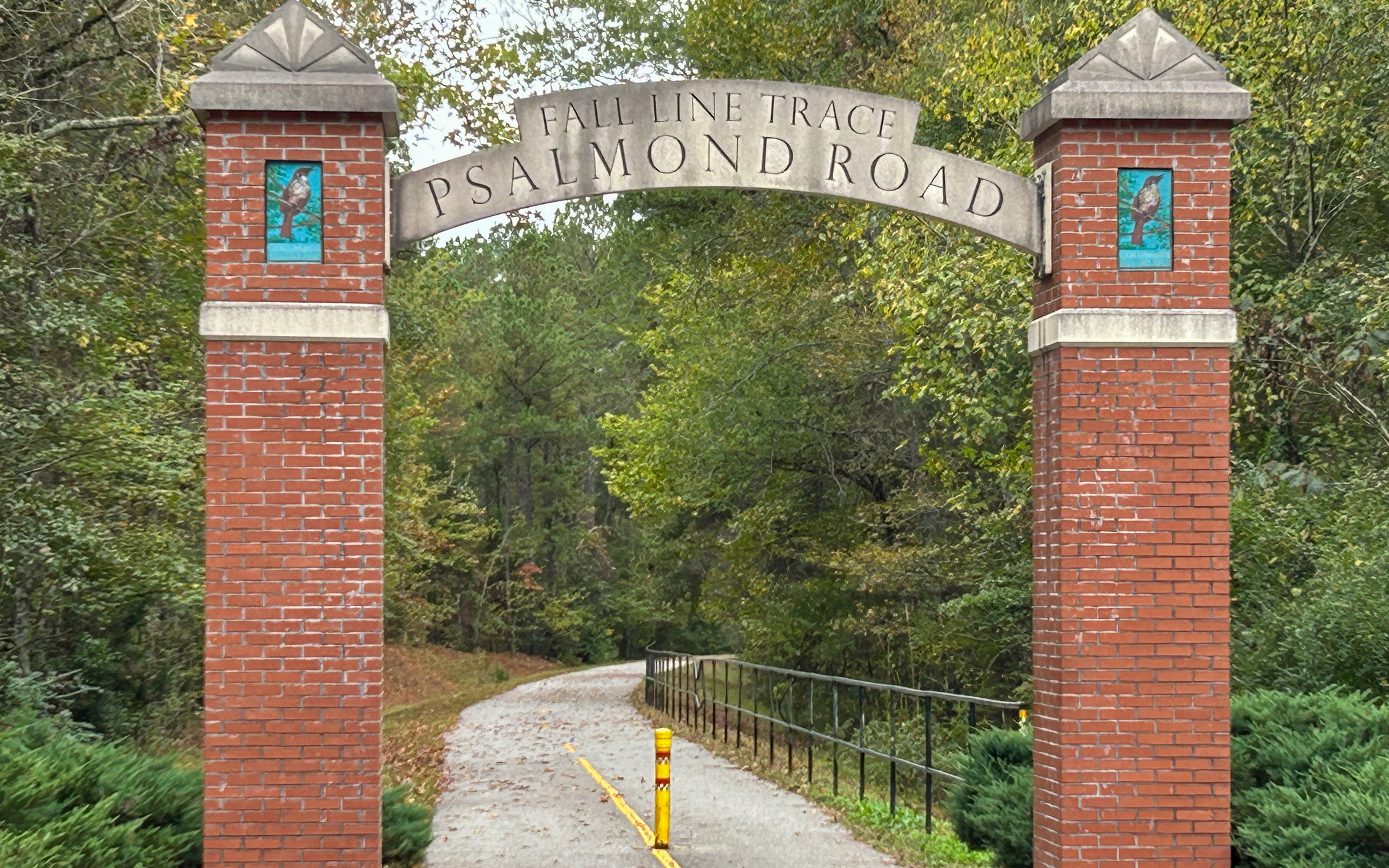
The trailhead is a tiny (about 12 parking spaces) parking lot located on Psalmond Road. We highly recommend that you do not arrive at this trailhead during school start or end times, as the lot is right behind a school on Psalmond Road and the entrance to the lot is completely blocked at those times by parents dropping off or picking up their kids. Not to mention the lot is usually full at those times, as well. Another time I would avoid is around 5-6 pm. The lot is usually full during that time due to people getting to the trail after work hours. There is a little bit of overflow parking out on the road, but we have managed to find a parking spot every time.


This trail is about 75% tree covered and many birds can be heard and seen, as well as an abundance of suicide squirrel traffic. There are about 8-10 road crossings, most of them are small residential type crossings with flashing lights and crossing signal buttons. We have found locals to be very attentive to these crossings and usually stop.
The trail goes through residential, very small industrial, and park areas without any loose (or out of voice control) dogs to speak of. It travels the north edge of Columbus State University and has a bridge of it’s own to cross the interstate. Even at the busier areas the entire trail is pedestrian and bicycle only traffic, so you really never have to content with much else other than trail traffic.

About a mile into the ride you will come across Flat Rock Park. This is a large, natural area that is loaded with picnic tables, trails, and even a frisbee golf course. There is a “hike and bike” trail in the park, as well if that interests you.
Be aware, this park does have bathrooms, but we have never found them to be opened or unlocked. This could be because of the times when we have been on the trail, or not, but we have been now multiple times throughout the year and they have never been open one time. We just assume that they are locked always at this point.


The first restroom facilities on the trail you come to, other than the off trail gas stations, etc., is this building. It is located across from the Columbus Mall and Airport. They have clean restrooms and a filtered water station for filling your bottles (thought the water station is hit or miss, sometimes it’s on and working, sometimes it’s not). There is also a bike fix-it station here if needed.
This is where we always stop for a snack and to stretch our legs, walk Edgar, etc. This is also a gathering point for other people, including a kids park next door, so there could be a good bit of people wandering around at times.


When you reach the end of the Fall Line Trace (FLT), you will be able to go north or south on the Chattahoochee Riverwalk Trail (CRT). On this day we went north. This trail winds it’s way north through trees and open vistas with beautiful views of the river. You cross over the dam, which is a fun twisty ride and then the trail ends at the northern trailhead.
We often park at this trailhead and ride the CRT from top to bottom, but on this day we were coming into town from the FLT. Just below the dam you can sometimes stop for a rest break and watch the whitewater rafters going down the rapids. This is usually very entertaining.


At the CRT north trailhead is another map of the entire Dragonfly Trail System. Although this system is small, compared to some of the ones in the northern states, we are so thankful that we have this group of trails to enjoy throughout the year so close to our home (about 30 minutes away). Well done, Columbus, GA!


Ride with GPS Route
Below is the embed for our actual Ride with GPS profile ride from this trip, you can click on the title for more details.
Thanks for Visiting!

Our aim is to share useful, ad-free content without clutter or sales noise. Support an ongoing ad-free experience with our tip jar, on our shop, or subscribe for free to my email list. I only send updates when new content is published! Sometimes I also use affiliate links. Did you like this article? Comment below, or send a private message here.